


ViewRanger GPS & Trails


ViewRanger GPS & Trails의 설명
ViewRanger is the complete offline mapping, navigation & guided trail service for Outdoor Enthusiasts. Perfect for backcountry exploring or simply days out in the frontcountry.
FREE MAPS INCLUDED
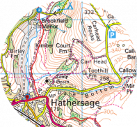
● OpenStreetMap© & OpenCycleMap Global street & terrain mapping
● Bing Aerial Imagery, Ski map, Transport map.
Use in-app purchasing (ViewRanger Store) to add official USGS/Accuterra topographic mapping for the whole of the USA. NR CAN maps are available for Canada as well as many other premium topographic maps for other countries.
-------------------------------
FEATURES INCLUDED
● GPS mapped location, even without cell coverage
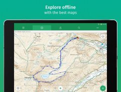
● Offline map mode* – store in advance using “Create Saved Map”
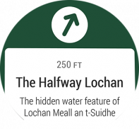
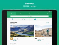
● Access to 1000's of route guides
● Track recording – view your path on map to keep or share, even add Flickr photos
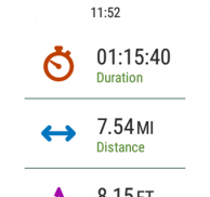
● Sports computer stats – view distance, speed, etc
● Real time location sharing** – BuddyBeacon (requires data connection)
● Active Route Navigation***
● Synchronises with web account for route planning, publishing and sharing. (http://my.viewranger.com)
● Integrated with Facebook, Twitter
-------------------------------
Already a fan of ViewRanger? Like us on Facebook or Follow us on Twitter for the latest news and updates:https://www.facebook.com/viewrangerhttps://www.twitter.com/viewranger-------------------------------
A choice of Global open-source maps are included for free and are streamed over data connection, that can be cached for offline use. With ViewRanger, you can choose the best map to use and you'll always know your mapped location, even where there’s no mobile signal.
It’s easy to record a track of your progress, so you can view your path and stats for every trip. Your tracks can be stored using your free web account (my.viewranger.com) or shared using Facebook or Twitter, you can even add photos using Flickr. You can also use BuddyBeacon, our PIN protected real-time** tracker & location sharing feature.
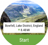
Planning a trip? Use ViewRanger to create & follow your own routes or simply download one from our growing library of expert and community generated walks and cycle rides***. And as our expert guided routes are created by book publishers, forest service and outdoors magazines they are packed with local knowledge to enhance your experience.
ViewRanger is designed for Hiking, Backpacking, Mountain Biking, Cycling, Skiing, Snowboarding, snowmobiling, Horse riding, cross country running, ATV and Quad biking, , Hot air ballooning, Micro-light flying, Nature watching, Photography and most outdoors activities. It’s used & trusted by most Search & Rescue teams.
-------------------------------
What our customers have to say:
“Simply the best off-road walking and cycling app anywhere."
“Not only is this an excellent app, but the helpfulness and speed of their response to my queries was exceptional."
-------------------------------
Paid for Map choice available in over 22 countries:
Great Britain Ordnance Survey, Ireland (OS Ireland and OS NI), Germany (BKG), France (IGN), USA (USGS/Accuterra), Austria and Liechtenstein (Kompass), Belgium (IGN/NGI) Canada (NR Can), Czech Republic (DPA), Finland (NLS), Netherlands (Kadaster), New Zealand (LINZ), Norway (Statkart), Slovenia (NMA) Spain (CNIG), The Canaries Islands (Discovery Walking), Sweden (Lantmäteriet)), Switzerland (Swisstopo), Denmark (Geodatastyrelsen), Madeira, Greece (TERRAIN Editions SA), Slovakia, (DPA), and parts of Italy.
*store in advance using “Create Saved Map”. ** requires mobile signal. *** may incur additional charges
Free Global maps © 2012 OpenStreetMap, CC-BY-SA & contributors.
Need more info? visit:http://www.viewranger.com. Any questions or feedback, please drop us an e-mail:support@viewranger.comViewRanger 완전한 오프라인 매핑, 탐색 & 아웃 도어 매니아를위한 가이드 흔적 서비스입니다. 오지는 frontcountry에서 밖으로 단순히 일을 탐험하거나 위해 완전히하십시오.
포함 된 무료지도
● OpenStreetMap의 © & OpenCycleMap 글로벌 거리 및 지형 매핑
● 빙 항공 사진, 스키지도, 교통지도.
미국의 전체에 대한 공식 USGS / Accuterra 지형 매핑을 추가하려면 응용 프로그램 내 구매 (ViewRanger 스토어)를 사용합니다. NR이지도는 캐나다뿐만 아니라 다른 나라에 대한 다른 많은 프리미엄 지형도에 사용할 수 있습니다.
-------------------------------
포함 된 기능
● GPS도 셀 커버리지없이, 위치를 매핑
● 오프라인지도 모드 * - 사용하여 사전에 상점은 "저장된지도 만들기"
● 경로 가이드의 1000에 액세스
● 트랙 녹음 - 심지어 플리커 사진을 추가, 유지 또는 공유 할 수있는지도에서 경로를 보려면
● 스포츠 컴퓨터 통계 - 볼 거리, 속도 등
● 실시간 위치 공유 ** - BuddyBeacon는 (데이터 연결이 필요합니다)
● 활성 경로 탐색 ***
●이 노선 계획, 게시 및 공유를위한 웹 계정과 동기화. (http://my.viewranger.com)
● 페이스 북, 트위터와 통합
-------------------------------
이미 ViewRanger의 팬? 페이스 북에서 우리를 좋아하거나 최신 뉴스와 업데이트를 트위터에 우리를 따르라 :https://www.facebook.com/viewrangerhttps://www.twitter.com/viewranger-------------------------------
글로벌 오픈 소스지도의 선택은 무료로 포함되어 오프라인 사용을 위해 캐시 할 수있는 데이터 연결을 통해 스트리밍됩니다. ViewRanger, 당신이 사용하는 가장 좋은지도를 선택할 수 있으며 더 이동할 수있는 신호가 없다 경우에도 당신은 항상 당신의 매핑 된 위치를 알 수 있습니다.
그것은 진보의 트랙을 녹음하는 것은 쉽다, 그래서 당신은 모든 여행 경로 및 통계를 볼 수 있습니다. 트랙 귀하의 무료 웹 계정 (my.viewranger.com)를 사용하여 저장 또는 페이스 북이나 트위터를 사용하여 공유 할 수 있습니다, 당신은 플리커를 사용하여 사진을 추가 할 수 있습니다. 또한 BuddyBeacon을 사용할 수 있습니다, 우리의 PIN은 추적 및 위치 공유 기능 ** 실시간 보호.
여행은 어떠세요? 자신의 경로를 생성 및 수행 할 ViewRanger를 사용하거나 전문가의 우리의 성장 라이브러리에서 하나를 다운로드 및 지역 사회가 *** 산책과 사이클 타기를 생성합니다. 우리의 전문 가이드 루트는 책 출판사, 산림 서비스와 야외 잡지에 의해 만들어 질 때 그리고 그들은 당신의 경험을 향상시키기 위해 지역의 지식으로 포장된다.
ViewRanger는 하이킹, 배낭 여행, 산악 자전거, 사이클링, 스키, 스노 보드, 스노 모빌, 승마, 실행 크로스 컨트리, ATV 쿼드 자전거, 열기구, 마이크로 빛 비행, 자연 관찰, 사진과 대부분의 야외 활동을 위해 설계되었습니다. 그것은 대부분의 검색 및 구조 팀에 의해 사용 및 신뢰 있어요.
-------------------------------
우리의 고객은 무슨 말을했는지 :
"어디서나 간단히 최고의 오프로드 도보 및 자전거 응용 프로그램."
"이 훌륭한 응용 프로그램입니다,하지만 내 질문에 대한 반응의 유용성과 속도가 뛰어난 있었다뿐만 아니라."
-------------------------------
22 개 이상의 국가에서 사용할 수있는지도 선택을위한 유료 :
영국 병기 조사, 아일랜드 (OS 아일랜드와 OS NI), 독일 (BKG), 프랑스 (IGN), 미국 (USGS / Accuterra), 오스트리아, 리히텐슈타인 (KOMPASS), 벨기에 (IGN / NGI) 캐나다 (NR는 할 수있다) 체코 (DPA), 핀란드 (NLS), 네덜란드 (Kadaster), 뉴질랜드 (츠), 노르웨이 (Statkart), 슬로베니아 (NMA) 스페인 (CNIG), 카나리아 제도 (디스커버리 산책), 스웨덴 (Lantmäteriet)), 스위스 (Swisstopo), 덴마크 (Geodatastyrelsen), 마데이라, 그리스 (지형 판 SA), 슬로바키아 (DPA), 이탈리아의 부분.
* "저장된지도 만들기"를 사용하여 사전에 저장할 수 있습니다. * 이동할 수있는 신호가 필요합니다. *** 추가 요금이 부과 될 수 있습니다
2012 OpenStreetMap의, CC-BY-SA 및 참여자 © 무료 세계지도.
추가 정보가 필요하십니까? 방문http://www.viewranger.com을.support@viewranger.com: 어떤 질문이나 의견은 저희에게 이메일을 떨어 뜨려주세요
ViewRanger GPS & Trails - 버전 10.11.66
(01-12-2021)

ViewRanger GPS & Trails - APK 정보
APK 버전: 10.11.66패키지: com.augmentra.viewranger.androidViewRanger GPS & Trails의 최신 버전


![인투 더 데드 [Into the Dead]](https://cdn6.aptoide.com/imgs/3/4/d/34df5fe7fab8efc173a278bf1fcb4d73_fgraphic.png?w=404&h=228)


동일 카테고리의 앱

좋아할 만한 것...


